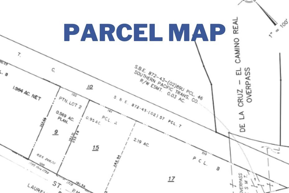
What Is A Parcel Map? – As the world becomes more urbanized, the demand for land is on the rise, making it essential to have a clear understanding of parcel maps. A parcel map is a detailed representation of a piece of land and its subdivisions, and it provides information about the size, boundaries, and location of the property.
Whether you are a property owner, a real estate professional, or a developer, a parcel map is a crucial tool that can help you make informed decisions. In this article, we will discuss What is a parcel map, including their purpose, how they are created, and how they can be used?
What is a Parcel Map?
A parcel map is a legal document that shows the boundary lines and dimensions of a piece of land. It provides a detailed depiction of the land’s division into separate parcels, and it is usually prepared by a licensed surveyor or civil engineer. The map is created to meet local regulations and zoning requirements, and it is often used to determine land values, taxation, and property ownership.
What Does Parcel In a Map Means?
In the context of a map, a parcel refers to a specific piece of land, usually defined by its boundaries and dimensions.
A parcel map, therefore, is a type of map that shows the location, boundaries, and dimensions of individual parcels of land within a larger area. These maps are often used by property owners, real estate professionals, and developers to understand the layout and potential uses of a piece of land.
How Are Parcel Maps Created?
Parcel maps are created by licensed professionals, such as surveyors and civil engineers, who use a variety of tools and techniques to gather information about the land.
They use GPS, aerial photography, and other mapping technologies to measure and plot the boundaries of the property accurately. Once the data has been collected, the surveyor or engineer will use computer-aided design (CAD) software to create a detailed map that meets local regulations and zoning requirements.
What Information is included in a Parcel Map?
Parcel maps contain a wealth of information about the land and its subdivisions. They show the size and shape of the property, the location of buildings, roads, and other structures, and the boundaries of each parcel. They also include information about zoning and land use restrictions, as well as any easements or rights of way that may affect the property.
Additionally, parcel maps may include details about the topography, soil type, and other environmental factors that can affect land use and development.
Why Are Parcel Maps Important?
Parcel maps are essential for many reasons. They provide accurate information about the size and shape of a piece of land, making it easier to determine its value and potential uses.
They also help ensure that property lines are clearly defined, reducing the risk of boundary disputes and other legal issues.
Parcel maps can also be used to determine zoning and land use restrictions, which can affect property values and development potential.
Additionally, parcel maps can be used by local governments for tax assessment purposes.
How Can Parcel Maps Be Used?
Parcel maps have a wide range of uses, and they are essential tools for many industries.
Real estate professionals use them to determine property values and potential uses, while developers use them to plan new projects and subdivisions.
Engineers and architects use parcel maps to design infrastructure and buildings that fit within the property’s boundaries.
Government agencies use them for land use planning, emergency response planning, and tax assessment purposes.
Homeowners and property buyers use them to understand the boundaries of their property and to identify any potential issues or restrictions.
Conclusion:
In conclusion, a parcel map is a crucial tool that provides a detailed representation of a piece of land and its subdivisions. Whether you are a property owner, a real estate professional, or a developer, understanding parcel maps is essential.
In this article, we have discussed everything you need to know about parcel maps, including their purpose, how they are created, and how they can be used. By understanding parcel maps, you can make informed decisions about land use and development, and avoid legal disputes and other issues.
FAQs: What is a Parcel Map?
How do I obtain a parcel map?
You can obtain a parcel map from your local government agency or by hiring a licensed surveyor or civil engineer to create one for you.
Can I use a parcel map to determine property boundaries?
Yes, a parcel map is a legal document that shows the exact boundary lines and dimensions of a piece of land. It can be used to determine property boundaries and to avoid boundary disputes.
Are parcel maps only used for urban areas?
No, parcel maps are used for all types of land, including rural and suburban areas.
Can parcel maps be updated or changed?
Yes, parcel maps can be updated or changed to reflect any changes in the property, such as new subdivisions, easements, or building construction.
