
In today’s digital age, geotagging is an essential feature for photos and videos. Geotagging is the process of adding location data to your media files, allowing you to identify the exact location where the picture or video was taken. This information is useful in many ways, from organizing your media files to creating detailed maps.
The best free geotagging software options include GeoSetter, Microsoft Pro Photo Tools, ExifTool, Phototheca, GeoPhoto and Geotag Photos Pro.
However, many people are not aware of the benefits of geotagging, and those who are aware of it might not know how to do it. The good news is that there are many free geotagging software options available that make adding location data easy.
In this article, we’ll explore the best free geotagging software options available and help you choose the best one for your needs.
What is Geotagging and How Does it Work?
Geotagging is a process of adding location data to your media files, including photos and videos. This location data can include the longitude and latitude of the location where the photo or video was taken, as well as other details like the altitude and direction of the camera.
Geotagging works by using GPS coordinates or other geographical information to pinpoint the exact location of the content. This information is usually added to the metadata of the file, which can be read by software applications that support geotagging.
Geotagging is particularly useful for photographers, GIS Professionals and travelers who want to keep track of where their photos were taken. It can also be used to create detailed maps of a particular area or to organize your media files based on location.
Why Use Geotagging Software?
By adding location information to digital media, geotagging can help you organize your photos and content more easily and accurately. Using geotagging software has many benefits, including:
- Organizing media files: Geotagging allows you to organize your media files based on location. You can easily find all the photos and videos taken in a particular location by using a geotagging software.
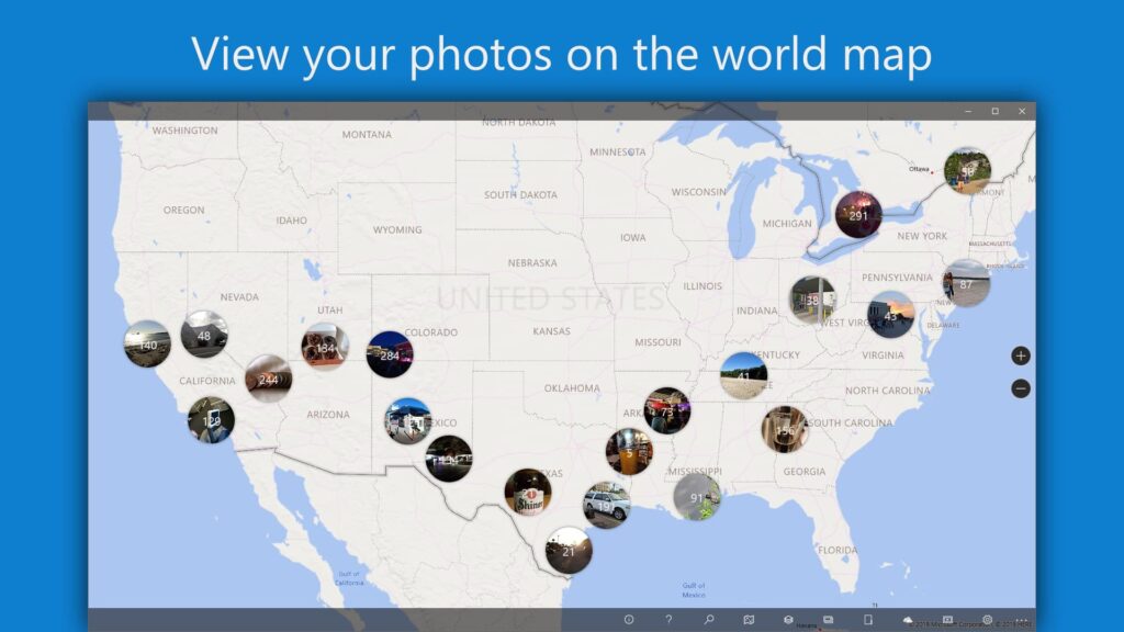
- Creating maps: Geotagging can be used to create detailed maps of a particular area. You can create maps of your travels, for example, or use geotagging to map out locations for a project.
- Sharing locations: Geotagging allows you to share your location with others. You can share your photos and videos on social media platforms like Instagram, Facebook, or Flickr, and viewers can see the exact location where the media was taken.
Best Free Geotagging Software
Geotagging software can also be used for mapping purposes, allowing you to track the exact location of a photo or video. This can be especially helpful when trying to remember where you took a particular photo or video. Additionally, geotagging software can help you organize your media files by location and make it easier to find them later on. Here are the best free geotagging software options available:
1. GeoSetter
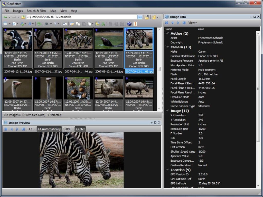
GeoSetter is a free geotagging software that allows you to add location data to your photos and videos. It supports a wide range of file formats, including JPEG, TIFF, and RAW. GeoSetter is easy to use and allows you to add location data manually or automatically. The software also has a mapping feature that allows you to see your photos and videos on a map.
2. Microsoft Pro Photo Tools
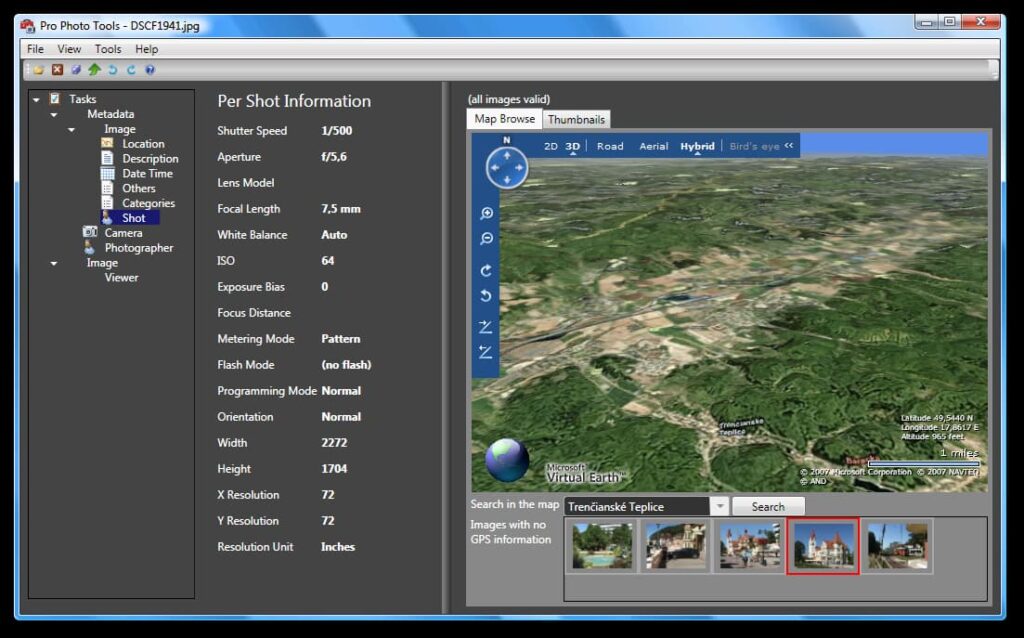
Microsoft Pro Photo Tools is another free geotagging software that allows you to add location data to your photos. It supports a wide range of file formats, including JPEG, TIFF, and RAW. The software also has a mapping feature that allows you to see your photos on a map.
3. ExifTool
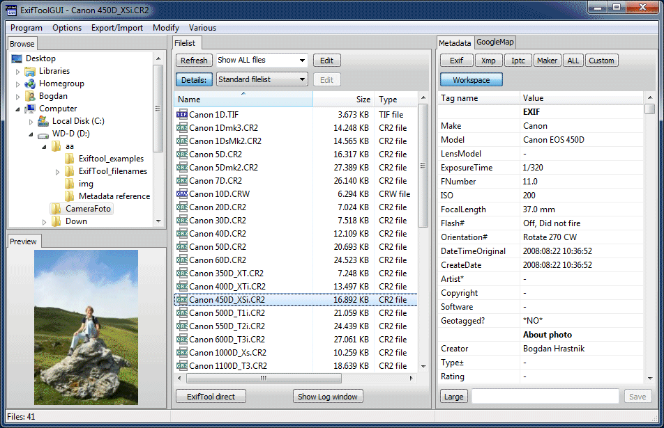
ExifTool is a free command-line tool that allows you to edit the metadata of your photos and videos, including adding location data. ExifTool supports a wide range of file formats, including JPEG, TIFF, and RAW. Although ExifTool doesn’t have a user-friendly interface, it is a powerful tool that can handle advanced geotagging tasks.
4. Phototheca
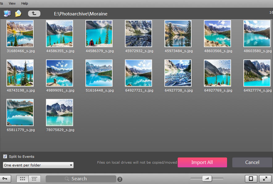
Phototheca is a free photo management software that also supports geotagging. It allows you to add location data to your photos and videos manually or automatically. The software also has a mapping feature that allows you to see your photos on a map.
5. GeoPhoto
GeoPhoto is a free geotagging software that allows you to add location data to your photos and videos. It supports a wide range of file formats, including JPEG and RAW. GeoPhoto is easy to use and allows you to add location data manually or automatically. The software also has a mapping feature that allows you to see your photos and videos on a map.
6. Geotag Photos Pro
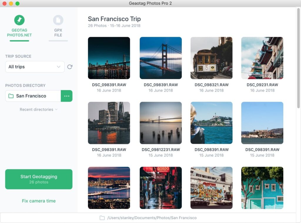
Geotag Photos Pro is a free geotagging app for mobile devices. It allows you to add location data to your photos and videos using your device’s GPS. The app also has a mapping feature that allows you to see your photos on a map.
7. Lightroom
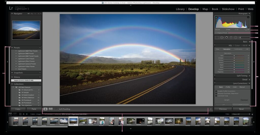
Lightroom is a popular photo editing and organization software that also offers geotagging capabilities. Its Map module allows users to visually locate their photos on a map and add or adjust geotag information. Lightroom also enables users to sync GPS data from their mobile devices to their photos, making it easy to geotag on the go.
8. PhotoMechanic
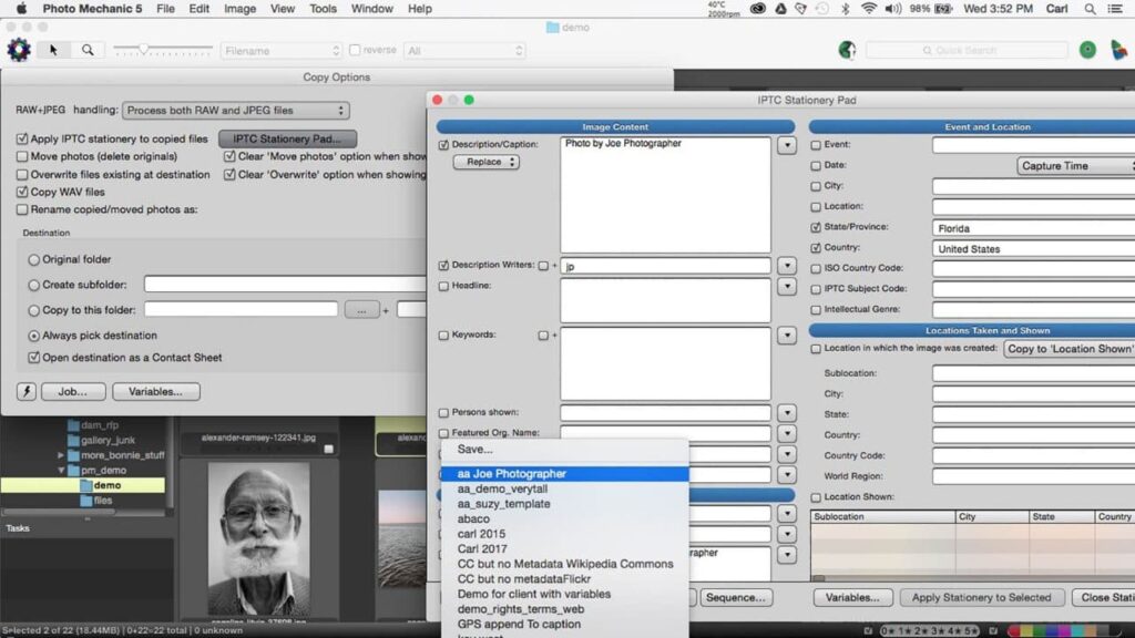
PhotoMechanic is a professional photo management software that includes geotagging features. With PhotoMechanic, users can easily add GPS coordinates to their photos and edit the location data. The software supports a variety of file formats and enables users to view and search for geotagged photos on a map.
9. GPicSync
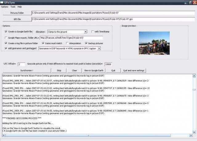
GPicSync is a free and simple geotagging software that allows users to add GPS data to their photos. The software supports multiple file formats and enables users to synchronize GPS data from their cameras with their photos. GPicSync also allows users to view their geotagged photos on a map.
10. PhotoLocator

PhotoLocator is a geotagging software designed for Windows users. With PhotoLocator, users can add GPS data to their photos and adjust the location information. The software also offers the ability to search for geotagged photos on a map and supports a variety of file formats. PhotoLocator also allows users to batch geotag multiple photos at once.
How To Choose The Best Geotagging Software?
Choosing the best geotagging software depends on your specific needs. Here are some factors to consider when choosing the best geotagging software:
- File format support: Make sure the software supports the file formats you use for your photos and videos.
- User-friendliness: Consider how easy the software is to use. Some software may have advanced features but can be difficult to navigate.
- Mapping feature: Look for software that has a mapping feature that allows you to see your photos on a map.
- Automatic geotagging: If you take a lot of photos, consider software that has automatic geotagging features that can save you time.
Conclusion
Geotagging is an essential feature for photos and videos in today’s digital age. There are many free geotagging software options available that make adding location data easy. The best free geotagging software options include GeoSetter, Microsoft Pro Photo Tools, HoudahGeo, ExifTool, Phototheca, GeoPhoto, and Geotag Photos Pro. When choosing the best geotagging software, consider factors like file format support, user-friendliness, mapping feature, and automatic geotagging.
FAQs Related To Best Free Geotagging Software
What is geotagging?
Geotagging is the process of adding location data to photos and videos, allowing you to identify the exact location where the picture or video was taken.
Why is geotagging important?
Geotagging is important for organizing media files, creating maps, and sharing locations.
What file formats are supported by geotagging software?
Geotagging software supports a wide range of file formats, including JPEG, TIFF, and RAW.