Topography is the shape of a landscape that is created due to various natural processes. The topography of Earth has been shaped over time by wind, water, and the growth of geologic features such as mountains. A human-made element also affects the topography of the Earth, as are the results of weathering, which are an ongoing process. This blog post is designed to teach you about different types of topography so you can better understand your world.
What Is Topography In Geography?
Topography is a physical feature that can have a significant impact on our daily life. It can be a hill, slope, or elevation. These features have the potential to change the climate and landscape of an area.
Topography is used in many different fields and has always been important for human survival. It helps to plan construction projects and mitigate natural disasters such as floods. Topographical data is also valuable for understanding the Earth’s history because it can show which areas were flooded or eroded by glaciers during previous ice ages.
What Are The Different Types of Topography?
There are many different types of topography. Some of them include landforms, textures, and elevations.
When you look at the topography around you, you might notice landforms, textures or elevations. Landforms are patterns made by the shape of the earth’s surface and they can be anything from mountains to valleys and plains.
Textures are also made by the shape of the earth’s surface as it is often a mix between highlands and lowlands.
Elevations show how high something is above sea level on earth.
These different types of topography make up Earth’s surface and everyone should know about them so they can better understand their world.
Different types of topography are specific to different regions. Whether you live in a desert or forest region, you’ll see some differences because of these regional variations.
Karst Topography
Karst topography is typically found in dry regions with porous rocks, such as limestone and sandstone. It is characterized by sinkholes, caves, disappearing streams, and often other landforms. Karst originates from a geological process called degassing which occurs when water filters through the sediments of a rock formation and creates fissures.
This process eventually causes the rocks to dissolve and form voids in the sediment. The water then travels through the voids, leaving behind dissolved salts. The process of karstification has continued since the Earth began and continues to this day. Some of the highest concentrations of karst are found in the areas of the world where the Earth’s crust is thin.
How Karst Topography Formed?
Karst topography is formed by the deposition of limestone, which is soluble in water. Limestone dissolves in water to form limestone-rich groundwater and when this acidic water comes in contact with rocks it begins to dissolve the rock. The surface forms an eroded landscape that is riddled with sinkholes, caves or caverns, and underground streams. Karst topographical features are created over time through the process of chemical weathering.
What Types of Features can be found in a Karst Landscape?
Karst topography typically contains features such as caves, springs, sinkholes, chimneys, gorges, and other similar geological formations. These are evident in this type of landscape due to the fact that porous rocks dissolve or erode easily. The dissolution of the rocks allows for the formation of caves which are often found high up on hilltops. Since rainwater is also injected with carbon dioxide from plant decomposition it creates a chemical reaction that creates an acidic soil full of cracks.
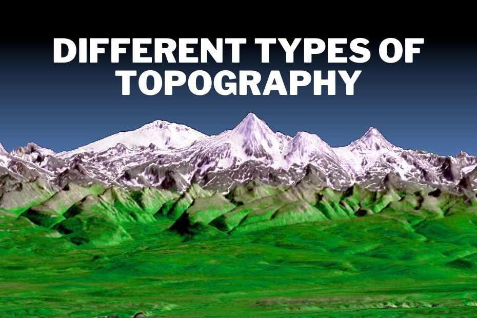
Mountain Topography
A mountain range is a series of peaks and valleys, which makes up a landform.
The tallest mountain on Earth, Mount Everest, is also the highest within any given mountain range. The Himalayas are the largest mountain range in the world and span five countries: India, Nepal, Pakistan, Bhutan and China.
Mountains are found on every continent, picturesque to some and inviting to the adventurous. They are all quite different, with their own unique features. Mountain topography is an important part of the mountain, as it dictates the type of weather conditions its inhabitants will experience. The highest mountain peaks have the most extreme climate, which can make them a haven for mountaineers and other high altitude climbers. The lower the altitude, the milder the climate and the easier the climate to live in.
The topography of a mountain can be used to identify certain geologic or landform features. For example, a steep slope from valley to mountain top may indicate an erosion-resistant rock type such as granite.
Mountains and Hills
The Rockies have formed over time from a long process of erosion, deposition, and uplifting. The mountains themselves did not form overnight but rather, the process took millions of years to form the mountainous terrain that we know today. Mountain formation starts from the ground up with the substrate below.
As time passes and erosion takes its toll on the landmass beneath it, sediment is deposited. This sediment accumulation creates new land that can eventually form a mountain. During the deposition of sediment is when plate tectonics come into play. The plate tectonic mechanism includes water, sea, and crust. The water acts as a lubricant between the plate and the sediment.
Vegetation & Elevation
Elevation and vegetation are important components of the landscape and every natural area has its own unique combination of these two variables. The rainfall and temperature found at different elevations create a diverse range of plant species. Plant communities vary by elevation because soil moisture, sunlight, wind, and other environmental factors change with height. For example, plants such as cedar trees live in shady environments beneath large rock piles that offer protection from the wind.
Valleys
Valleys are a special type of landscape. They are often referred to as “drainage basins”, as they form where water from rain or melting snow collects and flows through the terrain. The water will typically flow towards a natural depression or an artificial channel, which will carry it away from the basin. This is due to gravity, as well as downhill slope. A valley is formed when the terrain is flat, or nearly so, and the valley is caused by the weight of the terrain above.
Plains and Plateaus
Plains and plateaus topography can be found on the Great Plains and some parts of the Southwest. These regions contain low, flat land with little change in elevation. The Great Plains region is an area that is mostly flat with rolling hills.
A plateau can be defined as a raised or high ground level that is more than just a hill. A plateau can be a small or large area, ranging from a few hundred meters to several hundred kilometres.
Glaciers
Glaciers are large bodies of ice that have formed by accumulating snowfall that was then compressed into ice. The topography of a glacier includes many different shapes, sizes and textures. A glacier’s form is a result of its own movement, as well as the fluxes in climate conditions over time. Glaciers can take on a variety of forms, from a smooth surface to a jagged ridge. Some glaciers have been shaped to form an amphitheatre or even stairs.
A small glacier can be found in the form of a rille, a depression on the surface that is shaped by the action of flowing water on ice. Due to their large size, glaciers are not only an important part of the environment but also play a key role in shaping it.
The gradual movement of glaciers can cause many changes to the landscape due to natural processes that they initiate. For example, during slow movements, glaciers may have eroded bedrock by gouging out depressions in the ground, or through plucking and abrasion by creeks flowing under them.
Topography Examples
Topography is not just about what you see, but also includes hydrology (the water cycle) and meteorology (weather). It’s important to know how these external factors affect natural processes like erosion, deposition, and growth.
The type of topography that is most familiar to people is relief maps because they represent hills, valleys, cliffs, canyons, lakes, oceans rivers, roads etc.
How Is Topography Determined?
The most popular way to map topography is by using a topographic map that shows areas of high and low elevation.
Topography can be determined by many factors, including the amount of volcanic activity in an area, nearby faults, nearby mountain ranges, nearby rivers and lakes.
- The relative height of nearby mountains provide clues about the landscape over which they are located.
- Volcanoes can produce high peaks or depressions if located on a slope.
- Faults can create valleys near them.
- Flat areas are usually found near river deltas.
Conclusion: Types of Topography In Geography
In conclusion, it is important to understand that topography is an essential part of geography, which explains how the land of a particular area is shaped. Topography can refer to small-scale features of the land, such as hills and valleys, or more expansive features, such as rivers or mountains. Understanding topography may help people better understand their surroundings.